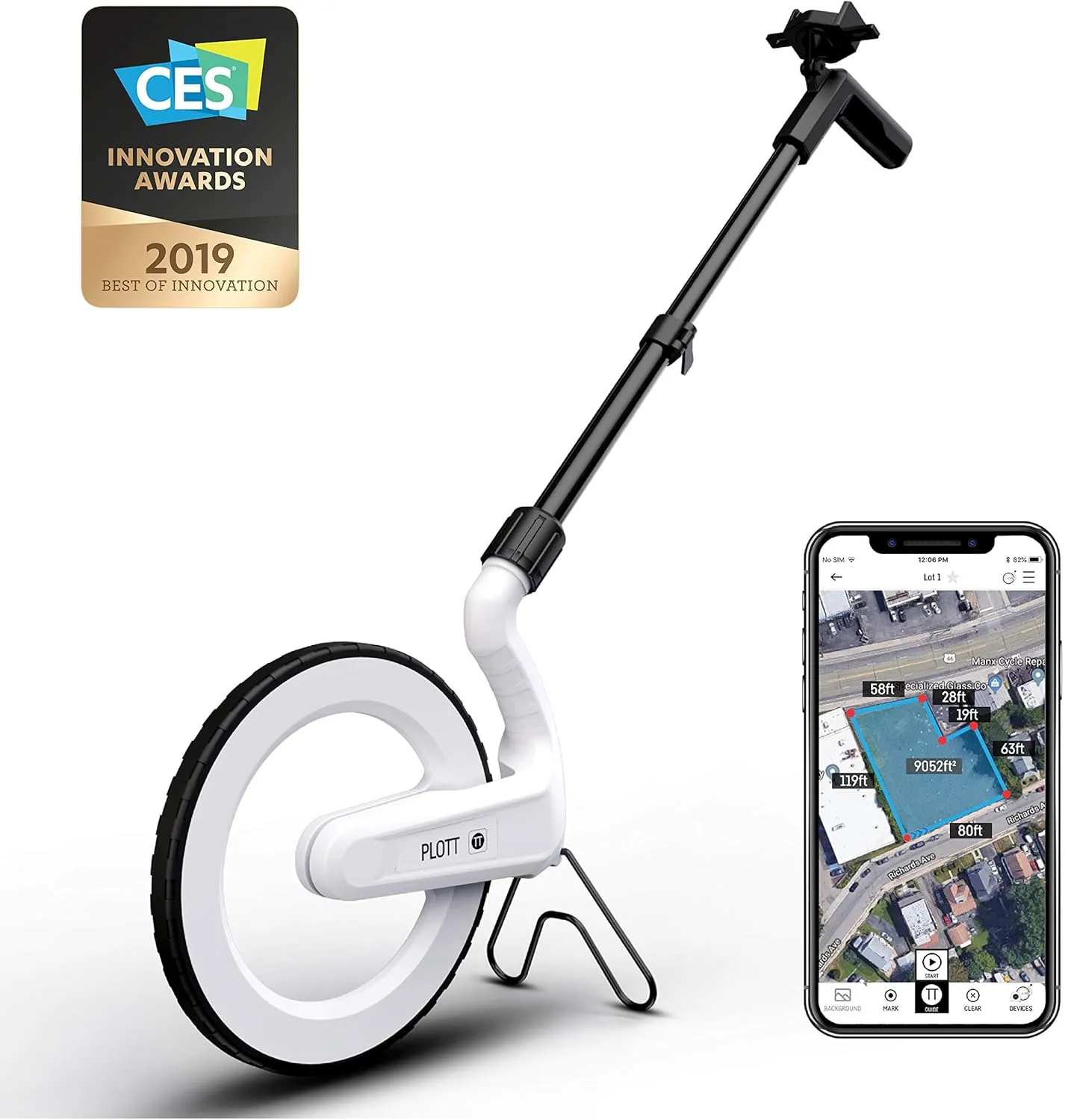
- SMART DIGITAL MAPPING & MEASURING Effortlessly capture dimensions in real time using the Lets Plott app. Simply wheel along any surfacestraight, curved, or irregularto create accurate digital maps of your project.
- SAVES TIME AND MONEY FOR MULTIPLE SECTORS Streamline measure, map & estimation for landscape, hardscape, concrete / construction, irrigation systems, outdoor lighting, paving and asphalt and many more.
- INSTANT AREA & COST ESTIMATION Automatically calculate square footage, cubic yards/feet, perimeter, and material costs to generate fast, accurate estimates helping you save time and reduce material waste.
- GUIDED NAVIGATION TO KEY POINTS Easily relocate important spots like valve boxes, underground utilities, and fence posts with real-world navigation that guides you back to marked locations.
- SEAMLESS EXPORT & SHARING Share project data effortlessly in multiple formats (JPG, DXF, CSV, PDF, and Plott File), making collaboration with teams, clients, and contractors quick and efficient.


Cart(0)

")


